
Key Takeaways:
- An estimated 1.8 billion people — 23% of the global population — are exposed to significant flood risk, concentrated in South and Southeast Asia.
- Most public weather apps forecast on grids spanning several kilometres to tens of kilometres; Pluvia forecasts operate on a 100-meter grid, refreshed every 2 minutes.
- "Hyperlocal" is the difference between knowing "rain today" and knowing "rain at your loading bay in 11 minutes" — resolution and refresh rate compound together, not separately.
- Nowcasting — tracking storms as they form — is what makes minute-level, site-specific predictions possible; traditional forecasting alone can't do this.
- Southeast Asia's convective storms are highly localized, so city-level forecasts systematically understate real, site-specific risk.
A typical weather app tells you it will rain in your city today. It won't tell you that the rain is currently three streets from your warehouse and will hit your loading bay in eleven minutes. That gap — between "it will rain somewhere in the region" and "it will rain exactly here, exactly when" — is what hyperlocal weather intelligence closes.
It's a gap that matters most in exactly the region where flood exposure is highest. An estimated 1.8 billion people, roughly 23% of the global population, are exposed to significant flood risk, and that exposure is concentrated in South and Southeast Asia (source: Flood Exposure and Poverty in 188 Countries (Rentschler et al., published in Nature Communications in 2022)). For operations leaders in the region, "hyperlocal weather intelligence" isn't a buzzword on a vendor's homepage. It's the difference between a forecast that's technically correct and a forecast that's actually usable.
1. The Resolution Problem: Why Kilometre-Scale Data Isn't Operational Data
Most public forecasts — the ones behind consumer weather apps, national meteorological bulletins, and many enterprise weather feeds — are built on grids spanning several kilometres, sometimes tens of kilometres. That resolution is entirely adequate for deciding whether to pack an umbrella. It is not adequate for deciding whether to pause a crane lift, reroute a delivery fleet, or delay a stage load-in.
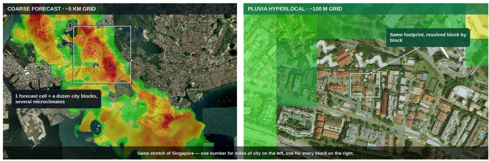
Figure: Same area of Singapore — left, a typical coarse-grid forecast; right, Pluvia's 100-meter hyperlocal grid resolving conditions block by block.
Here's why the gap matters in practice. A 5km grid cell in a city like Jakarta, Bangkok, or Ho Chi Minh City can easily span a dozen city blocks, several drainage catchments, and multiple distinct microclimates. A convective storm cell — the kind that dominates SEA rainfall — can dump significant rain over a few hundred meters while leaving the rest of that grid cell completely dry. When a forecast reports "60% chance of rain" for that entire cell, it's mathematically correct and operationally useless: it can't tell you whether the rain will hit your specific warehouse, your specific delivery route, or your specific work site.
Pluvia forecasts operate on a 100-meter grid — roughly the size of a single city block — small enough to distinguish one side of a business park from the other. That's not resolution for its own sake; it's resolution matched to the scale at which operational decisions actually get made. A site manager isn't deciding whether it will rain in Jakarta. They're deciding whether it will rain at their specific loading dock in the next fifteen minutes.
2. The Business Case: What Coarse Resolution Actually Costs
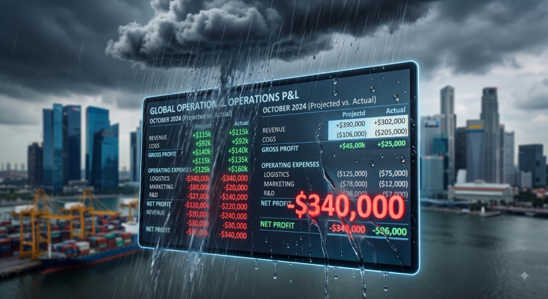
The cost of under-resolved weather data doesn't show up as a line item labeled "bad forecast." It shows up as unnecessary stoppages when a coarse model over-warns for an entire district, and as preventable disruptions when it under-warns because the rain fell in the 20% of the grid cell the forecast didn't distinguish.
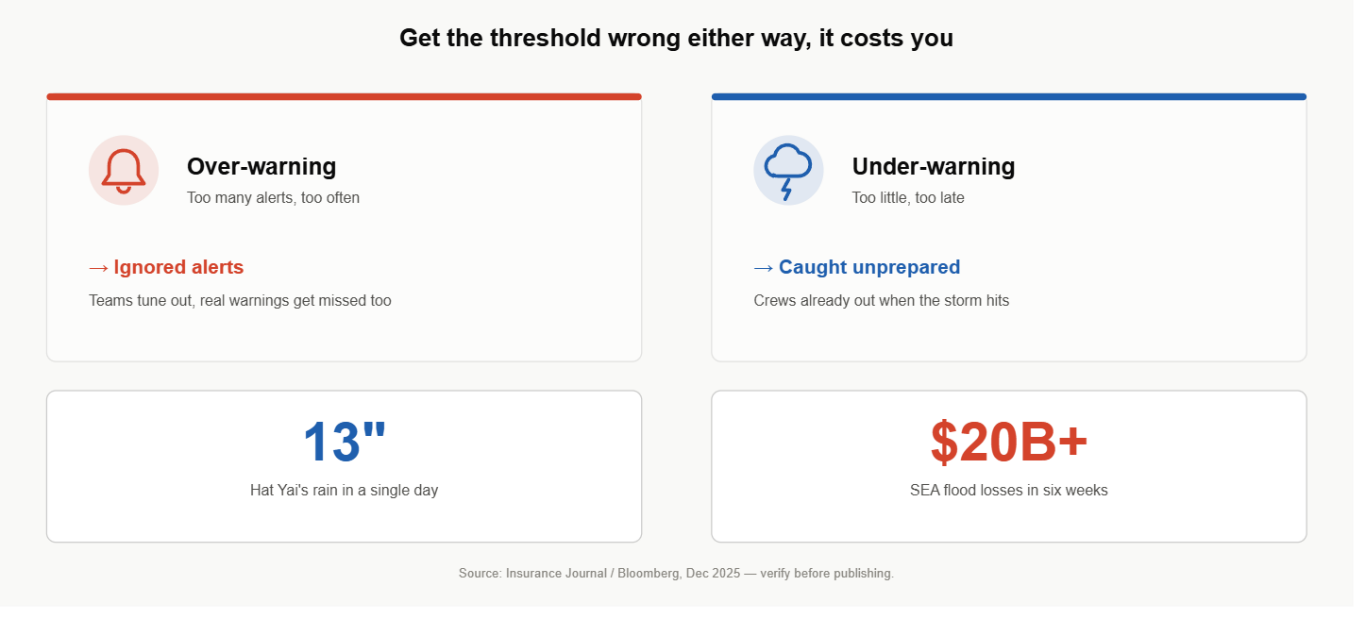
Both failure modes are expensive. Over-warning trains operations teams to ignore alerts — the classic "cry wolf" problem, where a dispatcher who's seen ten false "heavy rain" warnings for their zone stops trusting the eleventh, which happens to be real. Under-warning is worse: a delivery fleet, a construction crew, or an event team proceeds normally because the forecast showed no elevated risk for their broad region, only to be caught by a highly localized storm cell the coarse model averaged away.
Southeast Asia's 2025 monsoon season put a number on this risk at scale. Late in the year, three tropical cyclones coincided with the regular monsoon across five countries, producing rainfall totals described in reporting as "unseen in decades" in some locations, with combined losses exceeding $20 billion (source: Bloomberg, December 2025). Hat Yai, Thailand recorded 13 inches of rain in a single day — the highest one-day total there in three decades. Events at that scale get attributed to "the monsoon" in hindsight. But the operational failures inside them — a fleet caught mid-route, a site that didn't stop work in time — usually trace back to a forecast that was accurate at the regional level and useless at the site level.
3. How Hyperlocal Weather Intelligence Actually Works
Hyperlocal intelligence isn't just about resolution — it's about immediacy, and the two need to be built together, not bolted on separately.
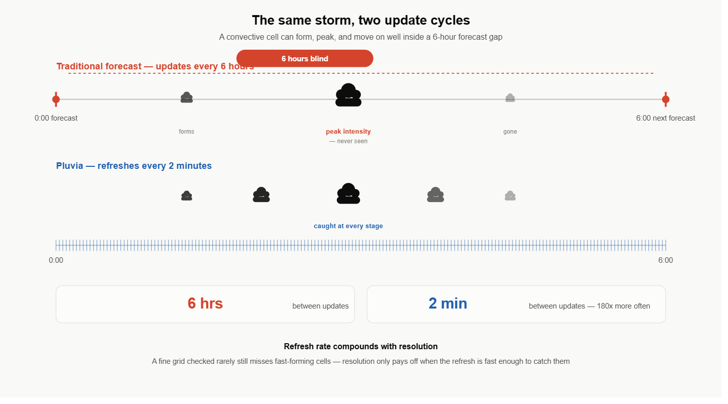
Nowcasting vs. traditional forecasting. Traditional forecasting models the atmosphere hours or days ahead, using physics-based simulations that are computationally expensive to run frequently. Nowcasting takes a different approach: it tracks storm cells as they form and move in near-real time, using a combination of radar, satellite, and ground-sensor data to project where an existing cell is headed over the next 15 to 180 minutes. This is what makes minute-level, location-specific predictions possible in the first place — you can't get 100-meter, 2-minute-refresh precision out of a model designed to run once every six hours.
Physics-informed AI. Pure machine-learning weather models, trained only on historical observation data, tend to struggle with extreme or rare events precisely because those events are underrepresented in training data. Physics-informed approaches constrain the model's outputs with the actual physical laws governing rainfall formation, storm propagation, and — for flood-specific applications — surface water runoff. In practice, this means the model doesn't have to have "seen" an exact historical analog of today's storm to produce a physically plausible, well-calibrated forecast for it. This matters disproportionately in the tropics, where convective systems intensify faster than the mid-latitude weather patterns most global models were originally trained on.
Why refresh rate compounds with resolution. A 100-meter grid refreshed once an hour is only marginally more useful than a 5km grid, because a fast-forming SEA storm can develop and move meaningfully within that hour — the high-resolution snapshot goes stale before anyone can act on it. Pluvia's 2-minute refresh cycle is designed specifically to keep pace with how quickly tropical convective storms actually evolve, so the 100-meter precision doesn't decay into a stale picture between updates.
4. Integration: What Operations Teams Actually Need to Know
Hyperlocal weather intelligence delivers its value differently depending on where in an operation it's applied, but the integration pattern is consistent across verticals.
- As a strategic outlook (10 days out): Extended-range trend data flags an elevated-risk stretch early enough to shape bigger decisions — blocking out contractor availability, pre-positioning inventory, or flagging a high-risk week on an event calendar before contracts are signed. Precision naturally drops at this range; the value is early warning for planning, not a site-specific call.
- As a planning input (24 hours out): Historical and forecast data at site-specific resolution informs staffing, scheduling, and contingency budgeting — deciding this morning whether tonight's outdoor event needs a covered backup, or whether tomorrow's concrete pour should shift to a lower-risk window.
- As a nowcast trigger (0–180 minutes out): This is where resolution and refresh rate matter most operationally. A threshold crossing — rainfall intensity, lightning proximity, wind speed — triggers a specific, pre-defined response: pause a crane lift, reroute a delivery fleet, activate an indoor event contingency.
As an API layer, not a dashboard someone has to remember to check: For logistics, construction, and event operators running at any scale, the highest-value integration point is feeding hyperlocal data directly into existing systems — dispatch and routing engines, permit-to-work systems, event management platforms — via REST API, rather than adding one more screen for a human to monitor manually. Pluvia's rAIn API is built for exactly this kind of integration, delivering structured, site-specific forecast data designed to plug into operational software without requiring a platform rebuild.
For teams evaluating any weather data provider, three questions cut through most of the noise: What's the actual grid resolution, in meters, not just marketing language like "hyperlocal"? What's the refresh cycle, in minutes, not just "real-time"? And is the underlying model trained or tuned for tropical convective weather specifically, or adapted from a model built for temperate climates? The answers to those three questions predict, more reliably than almost anything else, whether a given weather API will be operationally useful in Southeast Asia.
5. What Operations Leaders Should Do Now
The resolution and refresh-rate gap between consumer-grade weather data and what operations actually need isn't a new problem, but it's an increasingly costly one as Southeast Asia's rainfall intensity and flood exposure continue to grow. Teams still relying on kilometre-scale, hourly-refreshed forecasts aren't just working with slightly imprecise data — they're working with data that structurally cannot distinguish the difference between a dry site and a flooded one at the scale where their decisions actually happen.
The fix isn't complicated, even if the underlying modelling is: evaluate weather data providers on resolution and refresh rate first, region-specific model tuning second, and marketing language last.
About Pluvia: Pluvia.ai provides hyper-local weather and flood prediction APIs purpose-built for Southeast Asia — 100m resolution, 2-minute refresh, physics-informed AI, validated against PUB, Singapore's national water agency. Contact us at contact@pluvia.ai or visit pluvia.ai to see what 100-meter, 2-minute-refresh forecasting looks like for your specific sites.