
The science behind 100m weather precision
Built for fast-forming tropical rainfall. Independently validated across 47 gauge stations for proBuilt for Southeast Asia's fast-forming tropical rainfall, with independent validation against weather radar and ground observations across the region.ven accuracy.
Measurably more accurate. The data proves it
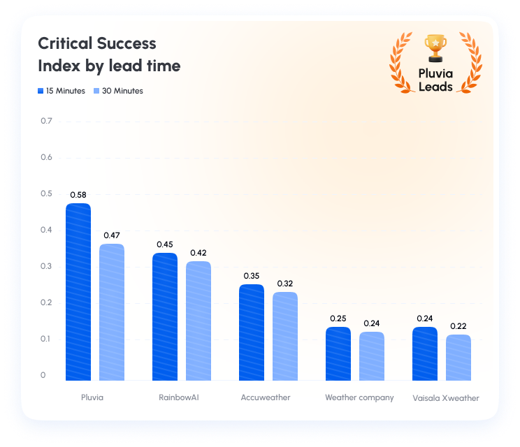
When tropical storms develop rapidly, the first 30 minutes can determine whether operations continue or shut down. Independent benchmarking shows Pluvia delivers the highest Critical Success Index (CSI) among leading providers, with a clear performance lead during this crucial 0–30 minute decision window.
higher 15-min CSI vs global ML baselines
higher 15-min CSI vs global ML baselines
How our models work differently
Built for real-world rainfall: physics-informed models, custom thresholds, and alerts when conditions demand action
01 - Model type
Physics informed Deep Learning
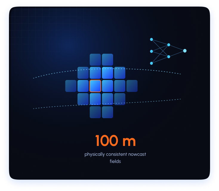
Our rainfall nowcasting model combines physics-informed neural networks with high-resolution, reanalysis-enhanced rainfall training data, tuned for tropical regions. This enables the system to better capture realistic storm growth, decay, and movement, while reducing physically implausible predictions during fast-evolving convective rainfall events.
100 m physically consistent nowcast fields
02 - Data Fusion
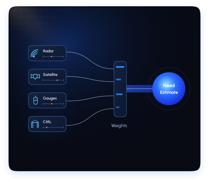
Bayesian multi source data blending
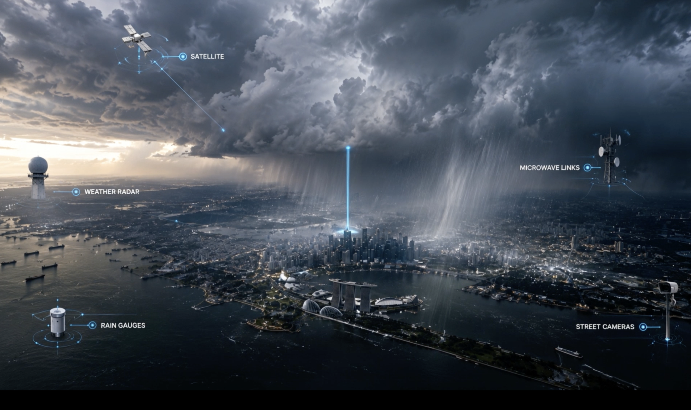
Pluvia integrates weather radar, gauge observations, satellite retrievals, and Commercial Microwave Link (CML) attenuation measurements through a hybrid machine learning and Bayesian fusion framework. Source-specific machine learning models estimate rainfall and quantify uncertainty, while Bayesian updating dynamically adjusts source weights based on real-time performance, data availability, and confidence. This enables robust rainfall estimation even in regions with incomplete radar coverage, ensuring consistent monitoring across Southeast Asia.
04 Sources - Radar, CML, gauges, satellite
03 - Training data
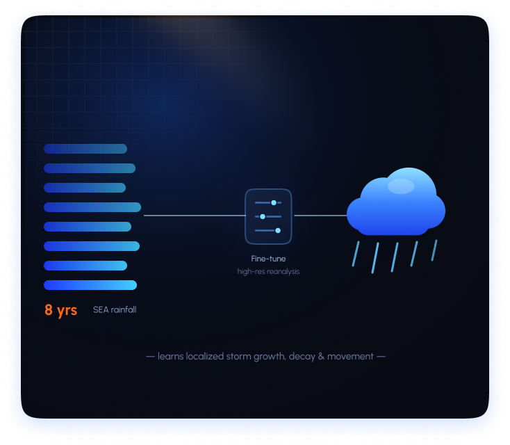
Fine tuned for tropical convective systems
Fast-forming tropical convective systems dominate Southeast Asia's rainfall, and most global models are too coarse to resolve their rapid evolution. Our model is trained on 8 years of regional SEA precipitation data, enhanced with high-spatial and high-temporal resolution reanalysis inputs, enabling it to learn localized storm growth, decay, and movement patterns that generic models often miss.
8 yrs of high-resolution regional storm data
04 - Uncertainty
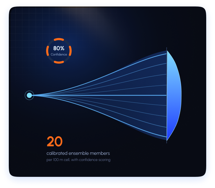
Ensemble nowcasting with confidence scoring
Calibrated ensemble nowcasts produce a probability distribution for each 100 m cell, not just a single rainfall estimate. Pluvia runs up to 20 ensemble members in parallel to quantify uncertainty, assign reliability-based confidence scores, and flag low-confidence predictions during rapidly evolving tropical storms.
20 calibrated ensemble members per cell
How Pluvia sees weather
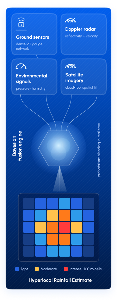
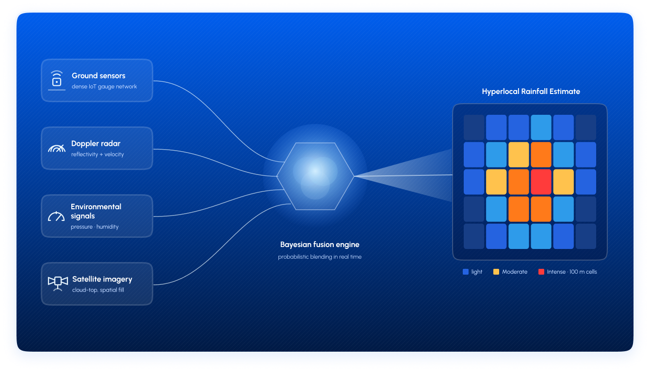
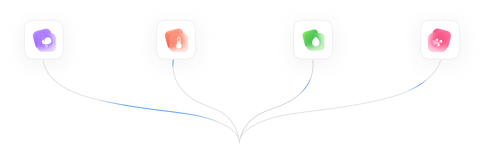
No single sensor sees the full picture. Pluvia fuses Doppler radar, surface gauges, Commercial Microwave Link data, and Satellite imagery into one Bayesian fusion engine delivering hyperlocal rainfall estimates that no single source could provide.
Ground sensors
Dense surface gauge and IoT network across urban SEA
Doppler radar
Real-time reflectivity and storm velocity tracking
Environmental signals
Pressure, humidity, and opportunistic ambient data
Satellite & auxiliary sources
Cloud-top imagery blended for spatial coverage
Proven against what actually happened
Purpose-built for Southeast Asia's most challenging weather. Every accuracy claim is backed by forecast-versus-actual validation data
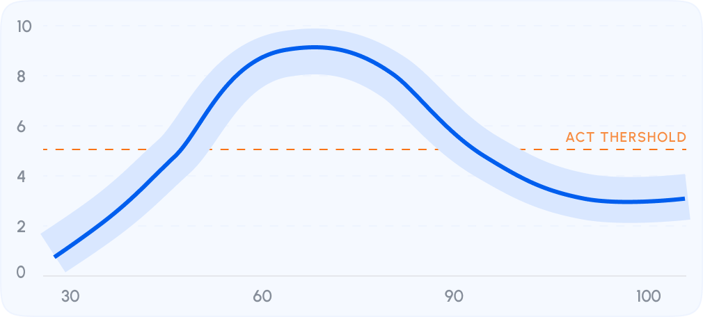
See how reliable each forecast is
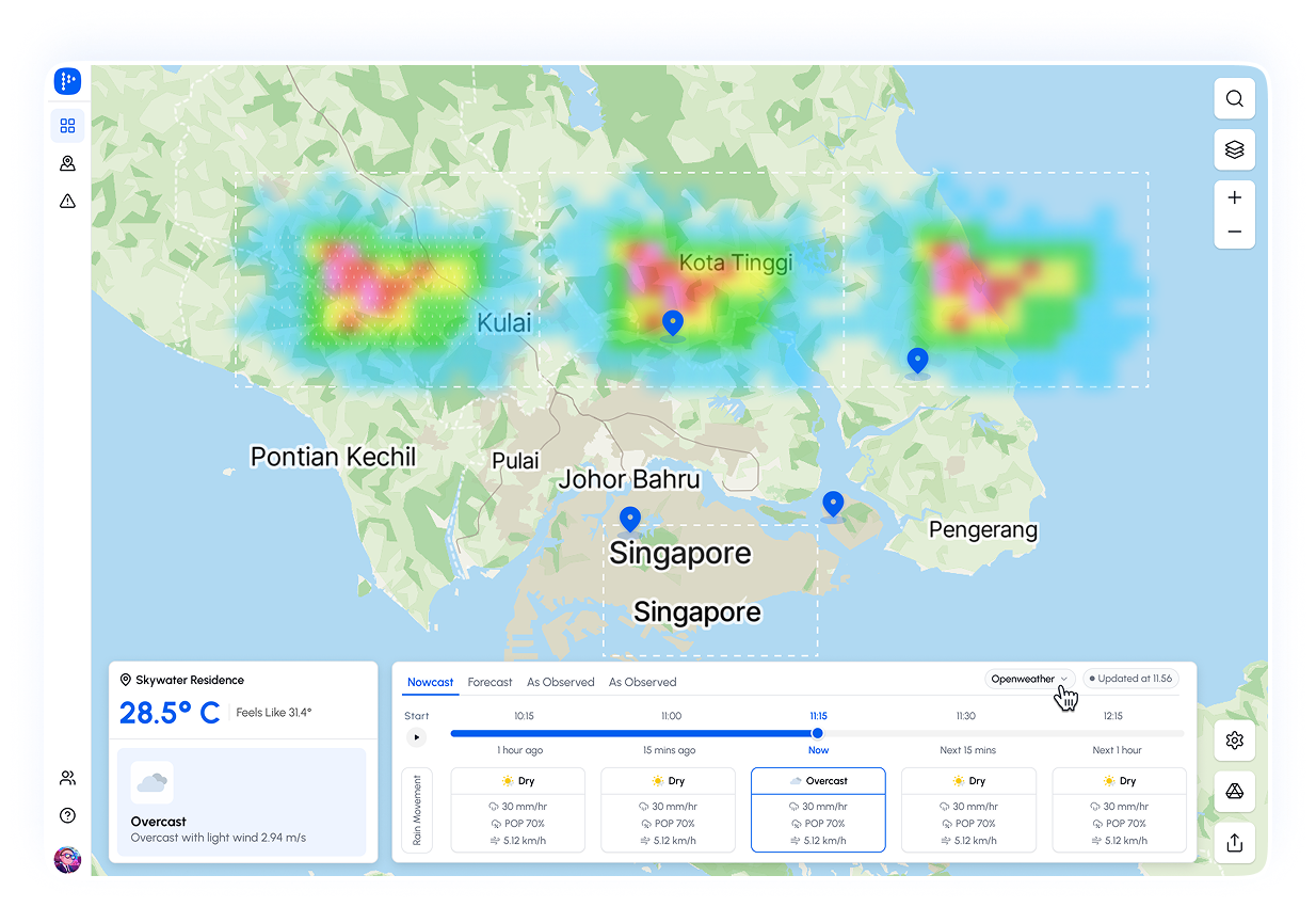
Pluvia shows forecast confidence alongside rainfall intensity, mapped to operational thresholds — so teams know exactly when to act, and when to hold.
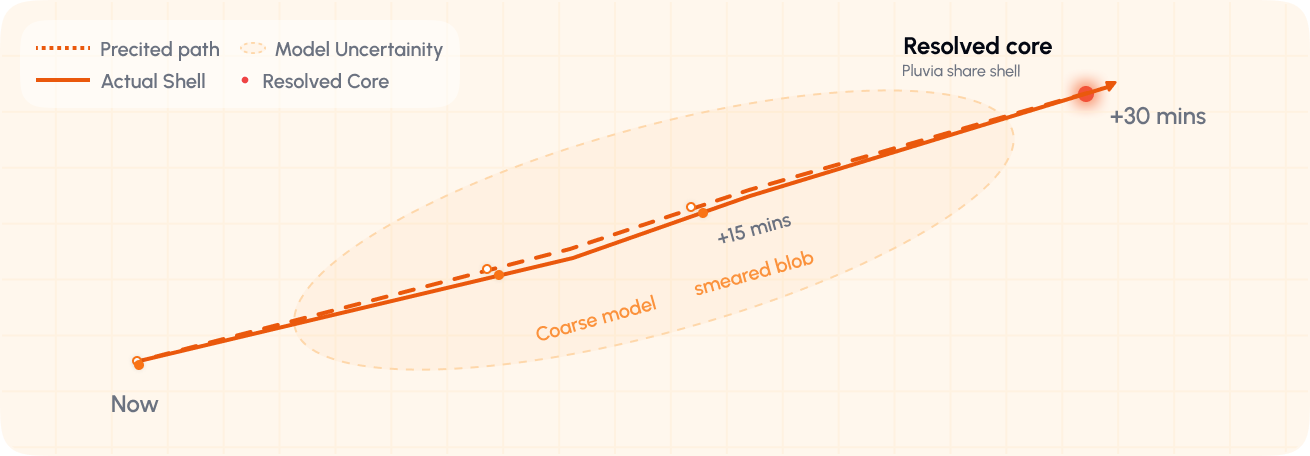
Built for fast-forming tropical rainfall
Tropical storms intensify in minutes. Where coarse models smear a single blob, Pluvia resolves the storm core predicted path tracked against the actual cell.
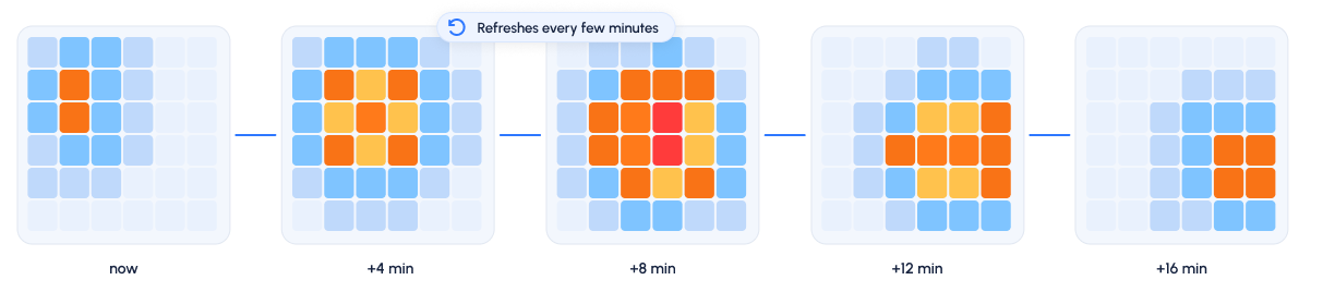
Updates fast when conditions change
Our nowcasting system refreshes every few minutes to capture rapid rainfall development across the grid.
Beyond rain modelling where the water goes
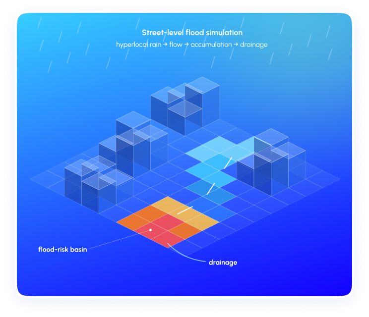
Pluvia doesn't only forecast rainfall. Our sub-grid hydrological models translate hyperlocal precipitation into high-resolution flood risk — simulating water flow, accumulation, and drainage at street level.
Science behind the product
Trusted research, independent validation, and real-world deployment across Southeast Asia.

Signal Strength to Storm Warning: How H2i and StarHub Are Redefining Rainfall Monitoring
1. A Novel Approach to Rainfall Monitoring
5 mins Read
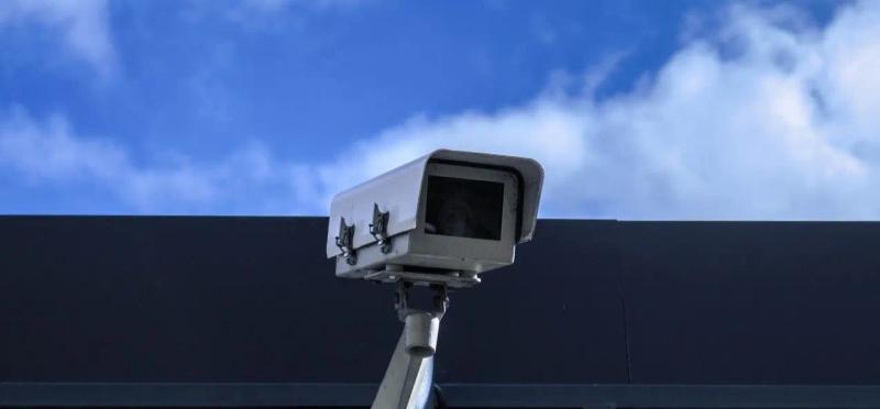
H2i to scale up use of street-level CCTVs as rain gauges
1. Overcoming Tropical Rainfall Challenges
4 mins Read
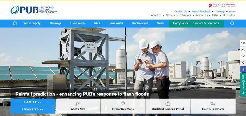
H2i to double the number of Singapore’s rainfall X-band radars and boost forecas...
1. Expanding Singapore's X-Band Radar Network
3 mins Read
Built for the rain. Act before it hits.
Stop reacting to weather. Pluvia gives Southeast Asia's most at-risk industries the hyperlocal intelligence to make the right call — before the rain changes everything
Book a Demo